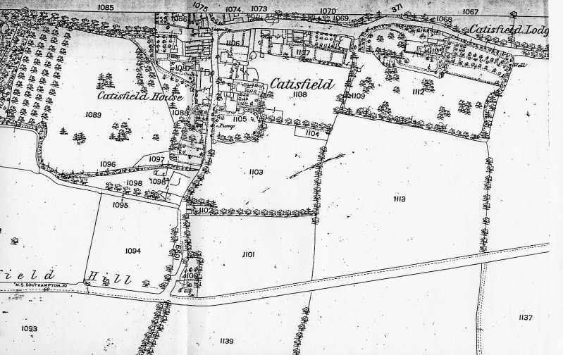
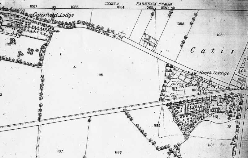
From Map published 1880, Surveyed 1859, Revised 1873.
"CATISFIELD"
This extracted section shows the grounds of Catisfield Lodge and Catisfield House . The second section shows the area east from Catisfield Lodge to where Catisfield Road meets The Avenue (A27) and Peak Lane (where stands today's 'Oast and Squire' pub)
This map also shows the field numbers.
<
| BACK to CATISFIELD Maps main page.. go back to Top of this page |
Catisfield pages originally 'on the web' January 1996 Most recent revision: 20 Feb 2006 © Doug Glading ..... 1996-2006 |