go back to Top of this page
Catisfield pages originally 'on the web' January 1996
Most recent revision: 15 Feb 2006 © Doug Glading ..... 1996-2006
|
Catisfield - In Maps: 1830 |
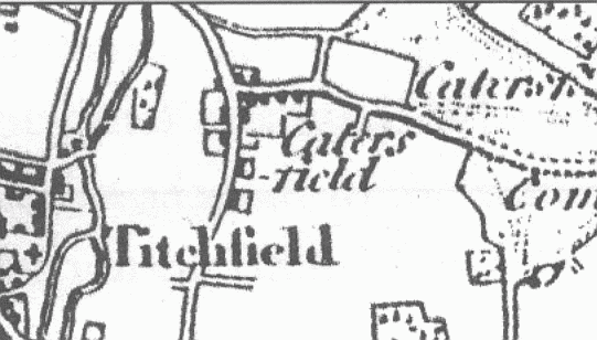
From a book about the Titchfield Canal. The map is entitled "Titchfield,
the River meon, the Canal and Hill Head as known about 1830"
This extracted section above shows "CATERSFIELD".
Although this is said to be a map of 1830 it does not show the Turnpike (built
1811). Otherwise this map is very similar to the map of 1810.
..
more text and explanation to go here.....
| BACK to CATISFIELD Maps main page.. go back to Top of this page |
Catisfield pages originally 'on the web' January 1996 Most recent revision: 15 Feb 2006 © Doug Glading ..... 1996-2006 |